
- Start >
- Groundwater >
- Waterlevel of upper layer >
- Bayern >
- HORNSTORF N6 >
- Chart of total period

Chart of total period HORNSTORF N6
Groundwater levels of the total period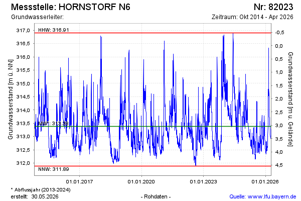
note
GW Messstelle im SN Öberauer Schleife
Groundwater level [m above sealevel]: 313.25
Distance to surface [m]: 3.17
Last value from 14.04.2026 06:00
Ground level [m above sealevel]: 316.42
| Date | Groundwater level [m above sealevel] |
|---|---|
| 14.04.2026 | 313.27 |
| 13.04.2026 | 313.24 |
| 12.04.2026 | 313.18 |
| 11.04.2026 | 313.15 |
| 10.04.2026 | 313.14 |
| 09.04.2026 | 313.22 |
| 08.04.2026 | 313.24 |
| 07.04.2026 | 313.16 |
© Bayerisches Landesamt für Umwelt 2026