
- Start >
- Groundwater >
- Waterlevel of upper layer >
- Bayern >
- HOHENLINDEN 904 >
- Chart of total period

Chart of total period HOHENLINDEN 904
Groundwater levels of the total period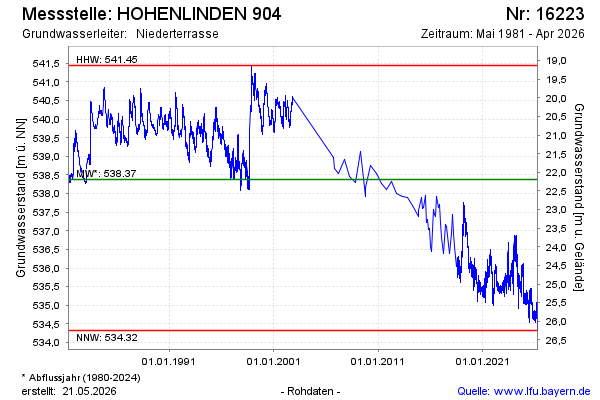
Groundwater level [m above sealevel]: 534.32
Distance to surface [m]: 26.25
Last value from 19.03.2026 11:22
Ground level [m above sealevel]: 560.57
| Date | Groundwater level [m above sealevel] |
|---|---|
| 19.03.2026 | 534.32 |
| 18.03.2026 | 534.32 |
| 17.03.2026 | 534.68 |
| 16.03.2026 | 534.99 |
| 15.03.2026 | 535.04 |
| 14.03.2026 | 535.09 |
| 13.03.2026 | 534.99 |
| 12.03.2026 | 534.96 |
© Bayerisches Landesamt für Umwelt 2026