Year chart of precipitation HÖTZENDORF Q2
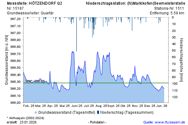
Groundwater level [m above sealevel]: 386,50
Distance to surface [m]: 2,27
Last value from 23.07.2026 10:00
Ground level [m above sealevel]: 388.77

Groundwater level [m above sealevel]: 386,50
Distance to surface [m]: 2,27
Last value from 23.07.2026 10:00
Ground level [m above sealevel]: 388.77