
- Start >
- Groundwater >
- Waterlevel of upper layer >
- Bayern >
- HOECHSTAEDT BL.KM73P7 >
- Chart of total period

Chart of total period HOECHSTAEDT BL.KM73P7
Groundwater levels of the total period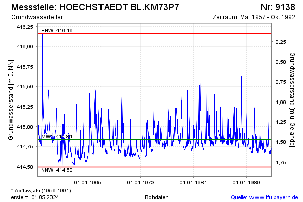
Groundwater level [m above sealevel]: 414.74
Distance to surface [m]: 1.57
Last value from 26.10.1992 12:00
Ground level [m above sealevel]: 416.31
| Date | Groundwater level [m above sealevel] |
|---|---|
| 19.10.1992 | 414.72 |
| 12.10.1992 | 414.73 |
| 05.10.1992 | 414.71 |
| 28.09.1992 | 414.69 |
| 21.09.1992 | 414.69 |
| 14.09.1992 | 414.69 |
| 07.09.1992 | 414.69 |
| 31.08.1992 | 414.68 |
© Bayerisches Landesamt für Umwelt 2026