
- Start >
- Groundwater >
- Waterlevel of upper layer >
- Bayern >
- HINTERSEE 765 >
- Chart of total period

Chart of total period HINTERSEE 765
Groundwater levels of the total period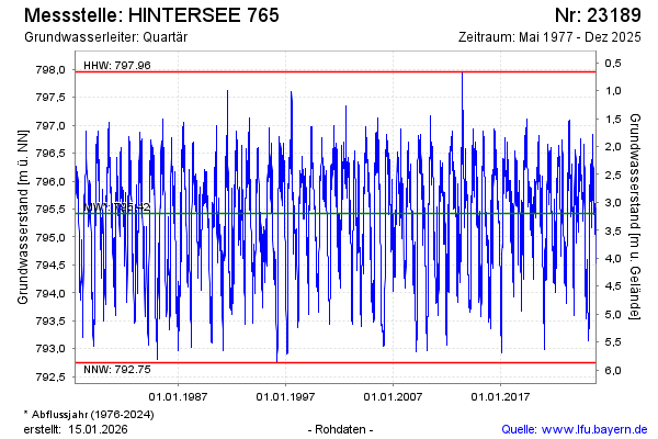
Groundwater level [m above sealevel]: 794.44
Distance to surface [m]: 4.18
Last value from 02.03.2026 08:35
Ground level [m above sealevel]: 798.62
| Date | Groundwater level [m above sealevel] |
|---|---|
| 02.03.2026 | 794.43 |
| 01.03.2026 | 794.40 |
| 28.02.2026 | 794.36 |
| 27.02.2026 | 794.32 |
| 26.02.2026 | 794.23 |
| 25.02.2026 | 793.99 |
| 24.02.2026 | 793.60 |
| 23.02.2026 | 793.27 |
© Bayerisches Landesamt für Umwelt 2026