
- Start >
- Groundwater >
- Waterlevel of upper layer >
- Bayern >
- HIENHEIM Q1 >
- Chart of total period

Chart of total period HIENHEIM Q1
Groundwater levels of the total period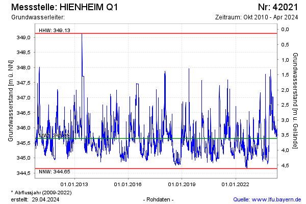
Groundwater level [m above sealevel]: 345.53
Distance to surface [m]: 3.73
Last value from 12.04.2026 10:00
Ground level [m above sealevel]: 349.26
| Date | Groundwater level [m above sealevel] |
|---|---|
| 12.04.2026 | 345.52 |
| 11.04.2026 | 345.50 |
| 10.04.2026 | 345.49 |
| 09.04.2026 | 345.51 |
| 08.04.2026 | 345.56 |
| 07.04.2026 | 345.54 |
| 06.04.2026 | 345.41 |
| 05.04.2026 | 345.35 |
© Bayerisches Landesamt für Umwelt 2026