
- Start >
- Groundwater >
- Waterlevel of upper layer >
- Bayern >
- Heinrichsthal S 7 >
- Chart of total period

Chart of total period Heinrichsthal S 7
Groundwater levels of the total period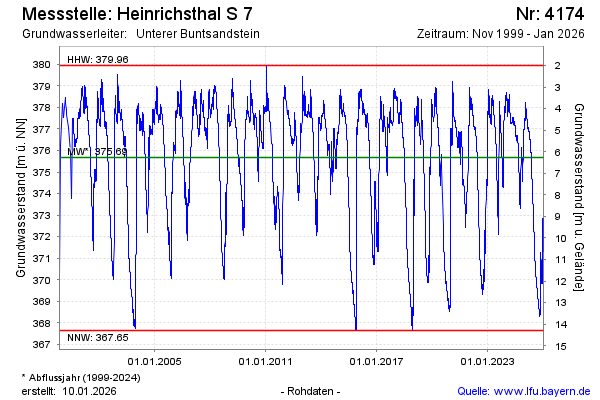
Groundwater level [m above sealevel]: 376.57
Distance to surface [m]: 5.37
Last value from 11.04.2026 09:00
Ground level [m above sealevel]: 381.94
| Date | Groundwater level [m above sealevel] |
|---|---|
| 11.04.2026 | 376.58 |
| 10.04.2026 | 376.59 |
| 09.04.2026 | 376.61 |
| 08.04.2026 | 376.64 |
| 07.04.2026 | 376.66 |
| 06.04.2026 | 376.69 |
| 05.04.2026 | 376.73 |
| 04.04.2026 | 376.74 |
© Bayerisches Landesamt für Umwelt 2026