
- Start >
- Groundwater >
- Waterlevel of upper layer >
- Bayern >
- Heiligenstadt 9 >
- Chart of total period

Chart of total period Heiligenstadt 9
Groundwater levels of the total period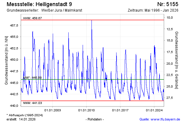
Groundwater level [m above sealevel]: 450.82
Distance to surface [m]: 18.37
Last value from 12.03.2026 10:00
Ground level [m above sealevel]: 469.19
| Date | Groundwater level [m above sealevel] |
|---|---|
| 12.03.2026 | 450.87 |
| 11.03.2026 | 450.99 |
| 10.03.2026 | 451.11 |
| 09.03.2026 | 451.21 |
| 08.03.2026 | 451.30 |
| 07.03.2026 | 451.39 |
| 06.03.2026 | 451.46 |
| 05.03.2026 | 451.48 |
© Bayerisches Landesamt für Umwelt 2026