
- Start >
- Groundwater >
- Waterlevel of upper layer >
- Bayern >
- HAUSEN TA 2 F >
- Chart of total period

Chart of total period HAUSEN TA 2 F
Groundwater levels of the total period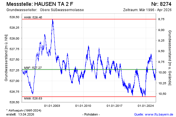
Groundwater level [m above sealevel]: 527.09
Distance to surface [m]: 10.11
Last value from 23.01.2026 11:00
Ground level [m above sealevel]: 537.20
| Date | Groundwater level [m above sealevel] |
|---|---|
| 23.01.2026 | 527.09 |
| 22.01.2026 | 527.11 |
| 21.01.2026 | 527.11 |
| 20.01.2026 | 527.07 |
| 19.01.2026 | 527.07 |
| 18.01.2026 | 527.07 |
| 17.01.2026 | 527.06 |
| 16.01.2026 | 527.07 |
© Bayerisches Landesamt für Umwelt 2026