
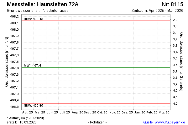
Current data HAUNSTETTEN 72A
note
kontinuierliche Messung bis zum 31.10.1995, seit 01.11.1995 Einzelmesswerte
Groundwater level [m above sealevel]: 497.50
Distance to surface [m]: 3.55
Last value from 03.06.2026 10:00
Ground level [m above sealevel]: 501.05
| Date | Groundwater level [m above sealevel] |
|---|---|
| 04.12.2024 | 497.65 |
| 01.07.2024 | 497.87 |
| 14.12.2023 | 497.92 |
| 13.06.2023 | 497.59 |
| 01.12.2022 | 497.57 |
| 15.06.2022 | 497.60 |
| 09.12.2021 | 497.52 |
| 21.07.2021 | 497.80 |