
- Start >
- Groundwater >
- Waterlevel of upper layer >
- Bayern >
- Haslau 1 >
- Chart of total period

Chart of total period Haslau 1
Groundwater levels of the total period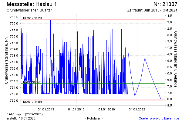
note
Die Messstelle wird nicht mehr beobachtet.
Groundwater level [m above sealevel]: 750.66
Distance to surface [m]: 7.45
Last value from 01.10.2024 10:00
Ground level [m above sealevel]: 758.11
| Date | Groundwater level [m above sealevel] |
|---|---|
| 14.05.2024 | 750.03 |
| 12.10.2023 | 749.95 |
| 04.05.2023 | 751.98 |
| 01.01.2023 | -- |
| 31.12.2022 | -- |
| 30.12.2022 | -- |
| 29.12.2022 | -- |
| 28.12.2022 | -- |
© Bayerisches Landesamt für Umwelt 2026