
- Start >
- Groundwater >
- Waterlevel of upper layer >
- Bayern >
- HALLERNDORF 4 >
- Current data

Current data HALLERNDORF 4
Groundwater levels of the last 12 months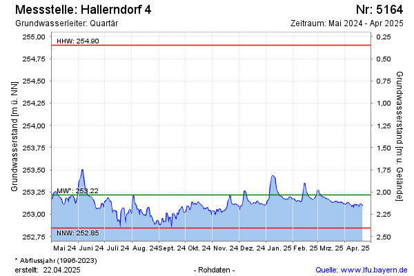
note
keine Tagaktuellen Daten: Datenfernübertragung defekt
Groundwater level [m above sealevel]: 253.13
Distance to surface [m]: 2.12
Last value from 20.04.2026 10:00
Ground level [m above sealevel]: 255.25
| Date | Groundwater level [m above sealevel] |
|---|---|
| 20.04.2026 | 253.13 |
| 19.04.2026 | 253.14 |
| 18.04.2026 | 253.14 |
| 17.04.2026 | 253.14 |
| 16.04.2026 | 253.14 |
| 15.04.2026 | 253.15 |
| 14.04.2026 | 253.14 |
| 13.04.2026 | 253.16 |
© Bayerisches Landesamt für Umwelt 2026