
- Start >
- Groundwater >
- Waterlevel of upper layer >
- Bayern >
- HAEUSER 3A/TR >
- Year chart of precipitation

Year chart of precipitation HAEUSER 3A/TR
Groundwater levels of the last 12 months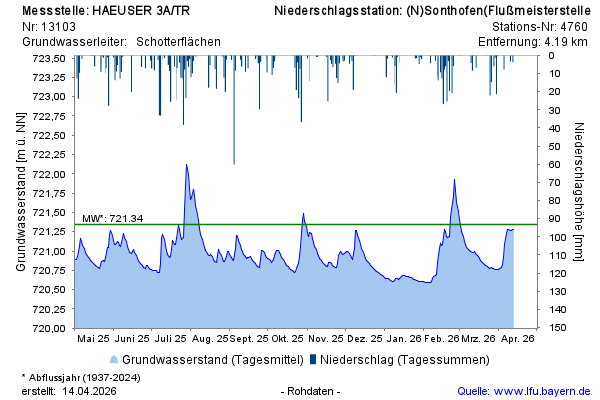
Groundwater level [m above sealevel]: 721,26
Distance to surface [m]: 2,89
Last value from 11.04.2026 09:00
Ground level [m above sealevel]: 724.15
© Bayerisches Landesamt für Umwelt 2026