
- Start >
- Groundwater >
- Waterlevel of upper layer >
- Bayern >
- H4-HWS Hirten >
- Chart of total period

Chart of total period H4-HWS Hirten
Groundwater levels of the total period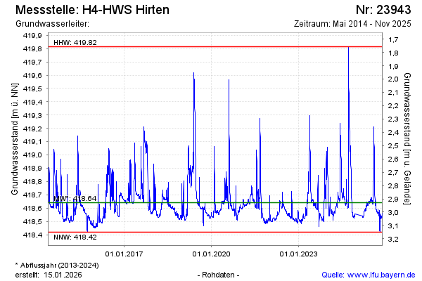
Groundwater level [m above sealevel]: 418.55
Distance to surface [m]: 3.02
Last value from 19.11.2025 11:00
Ground level [m above sealevel]: 421.57
| Date | Groundwater level [m above sealevel] |
|---|---|
| 19.11.2025 | 418.56 |
| 18.11.2025 | 418.56 |
| 17.11.2025 | 418.56 |
| 16.11.2025 | 418.56 |
| 15.11.2025 | 418.55 |
| 14.11.2025 | 418.53 |
| 13.11.2025 | 418.53 |
| 12.11.2025 | 418.53 |
© Bayerisches Landesamt für Umwelt 2026