
- Start >
- Groundwater >
- Waterlevel of upper layer >
- Bayern >
- H3-HWS Hirten >
- Chart of total period

Chart of total period H3-HWS Hirten
Groundwater levels of the total period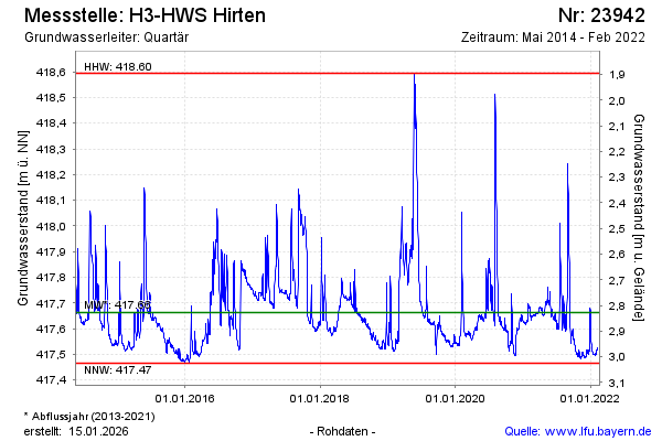
Groundwater level [m above sealevel]: 417.51
Distance to surface [m]: 2.98
Last value from 23.02.2022 19:24
Ground level [m above sealevel]: 420.49
| Date | Groundwater level [m above sealevel] |
|---|---|
| 07.02.2022 | 417.53 |
| 06.02.2022 | 417.52 |
| 05.02.2022 | 417.52 |
| 04.02.2022 | 417.51 |
| 03.02.2022 | 417.50 |
| 02.02.2022 | 417.50 |
| 01.02.2022 | 417.50 |
| 31.01.2022 | 417.50 |
© Bayerisches Landesamt für Umwelt 2026