
- Start >
- Groundwater >
- Waterlevel of upper layer >
- Bayern >
- GWM Kehrham-Ost >
- Year chart of precipitation

Year chart of precipitation GWM Kehrham-Ost
Groundwater levels of the last 12 months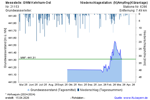
Groundwater level [m above sealevel]: 441,31
Distance to surface [m]: 2,94
Last value from 19.03.2026 12:12
Ground level [m above sealevel]: 444.25
© Bayerisches Landesamt für Umwelt 2026