
- Start >
- Groundwater >
- Waterlevel of upper layer >
- Bayern >
- Gunzenhausen Wald >
- Current data

Current data Gunzenhausen Wald
Groundwater levels of the last 12 months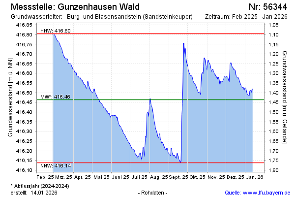
Groundwater level [m above sealevel]: 416.79
Distance to surface [m]: 1.11
Last value from 06.03.2026 13:00
Ground level [m above sealevel]: 417.90
| Date | Groundwater level [m above sealevel] |
|---|---|
| 06.03.2026 | 416.81 |
| 05.03.2026 | 416.82 |
| 04.03.2026 | 416.82 |
| 03.03.2026 | 416.83 |
| 02.03.2026 | 416.84 |
| 01.03.2026 | 416.85 |
| 28.02.2026 | 416.86 |
| 27.02.2026 | 416.88 |
© Bayerisches Landesamt für Umwelt 2026