
- Start >
- Groundwater >
- Waterlevel of upper layer >
- Bayern >
- GUNDELFINGERMOOS B5 >
- Chart of total period

Chart of total period GUNDELFINGERMOOS B5
Groundwater levels of the total period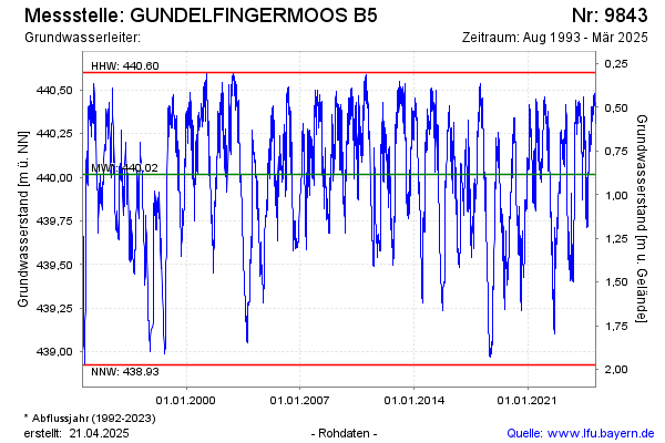
Groundwater level [m above sealevel]: 440.19
Distance to surface [m]: 0.71
Last value from 07.04.2026 14:31
Ground level [m above sealevel]: 440.90
| Date | Groundwater level [m above sealevel] |
|---|---|
| 07.04.2026 | 440.20 |
| 06.04.2026 | 440.22 |
| 05.04.2026 | 440.24 |
| 04.04.2026 | 440.25 |
| 03.04.2026 | 440.26 |
| 02.04.2026 | 440.28 |
| 01.04.2026 | 440.30 |
| 31.03.2026 | 440.31 |
© Bayerisches Landesamt für Umwelt 2026