
- Start >
- Groundwater >
- Waterlevel of upper layer >
- Bayern >
- GUN_ReNat_2 >
- Current data

Current data GUN_ReNat_2
Groundwater levels of the last 12 months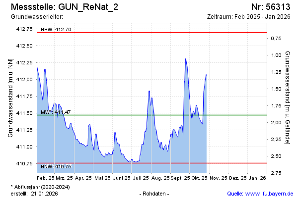
Groundwater level [m above sealevel]: 411.59
Distance to surface [m]: 1.77
Last value from 15.01.2026 09:00
Ground level [m above sealevel]: 413.36
| Date | Groundwater level [m above sealevel] |
|---|---|
| 15.01.2026 | 411.59 |
| 14.01.2026 | 411.57 |
| 13.01.2026 | 411.48 |
| 12.01.2026 | 411.40 |
| 11.01.2026 | 411.40 |
| 10.01.2026 | 411.34 |
| 09.01.2026 | 411.17 |
| 08.01.2026 | 411.10 |
© Bayerisches Landesamt für Umwelt 2026