
- Start >
- Groundwater >
- Waterlevel of upper layer >
- Bayern >
- GUN_HW_KB 4 >
- Current data

Current data GUN_HW_KB 4
Groundwater levels of the last 12 months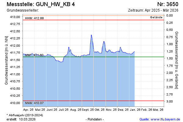
Groundwater level [m above sealevel]: 411.79
Distance to surface [m]: 1.26
Last value from 15.01.2026 08:00
Ground level [m above sealevel]: 413.05
| Date | Groundwater level [m above sealevel] |
|---|---|
| 15.01.2026 | 411.79 |
| 14.01.2026 | 411.78 |
| 13.01.2026 | 411.76 |
| 12.01.2026 | 411.75 |
| 11.01.2026 | 411.73 |
| 10.01.2026 | 411.73 |
| 09.01.2026 | 411.72 |
| 08.01.2026 | 411.69 |
© Bayerisches Landesamt für Umwelt 2026