
- Start >
- Groundwater >
- Waterlevel of upper layer >
- Bayern >
- GUN ZUR ALTMUEHL 7223 >
- Chart of total period

Chart of total period GUN ZUR ALTMUEHL 7223
Groundwater levels of the total period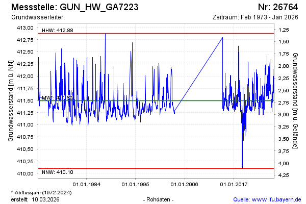
Groundwater level [m above sealevel]: 411.82
Distance to surface [m]: 2.39
Last value from 15.07.2024 10:35
Ground level [m above sealevel]: 414.21
| Date | Groundwater level [m above sealevel] |
|---|---|
| 15.07.2024 | 411.83 |
| 14.07.2024 | 411.84 |
| 13.07.2024 | 411.82 |
| 12.07.2024 | 411.77 |
| 11.07.2024 | 411.74 |
| 10.07.2024 | 411.60 |
| 09.07.2024 | 411.62 |
| 08.07.2024 | 411.62 |
© Bayerisches Landesamt für Umwelt 2024