
- Start >
- Groundwater >
- Waterlevel of upper layer >
- Bayern >
- Güntersleben >
- Chart of total period

Chart of total period Güntersleben
Groundwater levels of the total period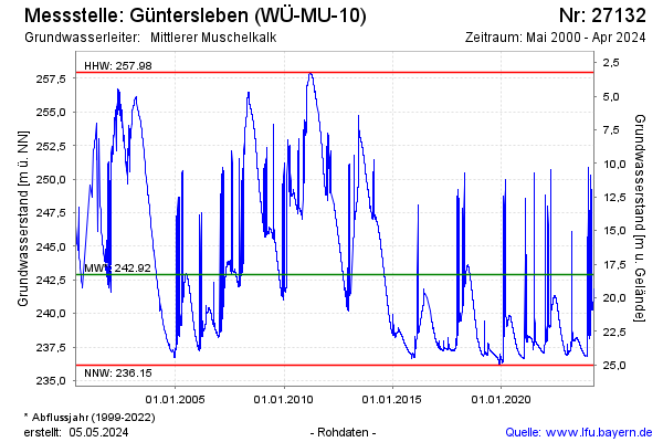
Groundwater level [m above sealevel]: 247.70
Distance to surface [m]: 13.47
Last value from 24.02.2026 12:25
Ground level [m above sealevel]: 261.17
| Date | Groundwater level [m above sealevel] |
|---|---|
| 24.02.2026 | 249.52 |
| 23.02.2026 | 248.59 |
| 22.02.2026 | 245.09 |
| 21.02.2026 | 241.03 |
| 20.02.2026 | 245.90 |
| 19.02.2026 | 247.38 |
| 18.02.2026 | 246.14 |
| 17.02.2026 | 241.23 |
© Bayerisches Landesamt für Umwelt 2026