
Chart of total period GROSSELFINGEN E5A
Groundwater level [m above sealevel]: 411.33
Distance to surface [m]: 0.87
Last value from 18.11.2025 14:40
Ground level [m above sealevel]: 412.20
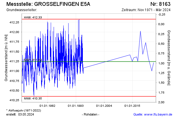
| Date | Groundwater level [m above sealevel] |
|---|---|
| 31.10.2024 | 411.09 |
| 06.03.2024 | 411.29 |
| 04.04.2023 | 411.21 |
| 07.07.2022 | 411.00 |
| 03.03.2021 | 411.33 |
| 20.02.2020 | 411.73 |
| 24.01.2019 | 411.43 |
| 23.01.2018 | 412.02 |