
- Start >
- Groundwater >
- Waterlevel of upper layer >
- Bayern >
- GRAFING T2 >
- Current data

Current data GRAFING T2
Groundwater levels of the last 12 months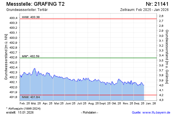
Groundwater level [m above sealevel]: 432.02
Distance to surface [m]: 4.02
Last value from 03.05.2026 09:00
Ground level [m above sealevel]: 436.04
| Date | Groundwater level [m above sealevel] |
|---|---|
| 03.05.2026 | 432.03 |
| 02.05.2026 | 432.00 |
| 01.05.2026 | 431.98 |
| 30.04.2026 | 431.98 |
| 29.04.2026 | 431.99 |
| 28.04.2026 | 432.01 |
| 27.04.2026 | 432.01 |
| 26.04.2026 | 432.02 |
© Bayerisches Landesamt für Umwelt 2026