
- Start >
- Groundwater >
- Waterlevel of upper layer >
- Bayern >
- GRAFING/GRASSAU 981/1F >
- Year chart of precipitation

Year chart of precipitation GRAFING/GRASSAU 981/1F
Groundwater levels of the last 12 months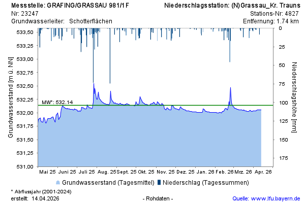
Groundwater level [m above sealevel]: 532,06
Distance to surface [m]: 1,26
Last value from 08.03.2026 09:00
Ground level [m above sealevel]: 533.32
© Bayerisches Landesamt für Umwelt 2026