
- Start >
- Groundwater >
- Waterlevel of upper layer >
- Bayern >
- GERSTHOFEN 649A >
- Chart of total period

Chart of total period GERSTHOFEN 649A
Groundwater levels of the total period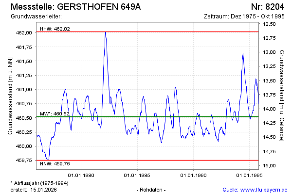
Groundwater level [m above sealevel]: 460.74
Distance to surface [m]: 13.92
Last value from 31.10.1995 23:59
Ground level [m above sealevel]: 474.66
| Date | Groundwater level [m above sealevel] |
|---|---|
| 29.10.1995 | 460.75 |
| 14.10.1995 | 460.86 |
| 08.10.1995 | 460.89 |
| 02.10.1995 | 460.92 |
| 19.09.1995 | 461.00 |
| 16.09.1995 | 461.03 |
| 12.09.1995 | 461.05 |
| 10.09.1995 | 461.06 |
© Bayerisches Landesamt für Umwelt 2026