
- Start >
- Groundwater >
- Waterlevel of upper layer >
- Bayern >
- GERSTHOFEN 648 >
- Chart of total period

Chart of total period GERSTHOFEN 648
Groundwater levels of the total period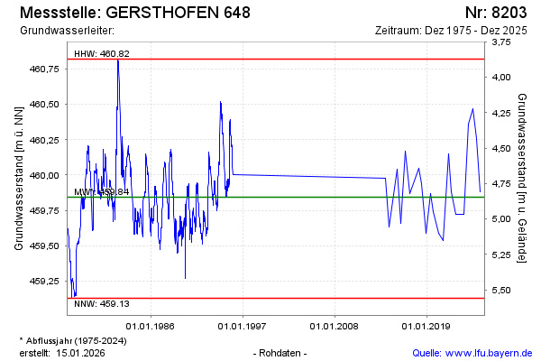
Groundwater level [m above sealevel]: 459.65
Distance to surface [m]: 5.04
Last value from 16.12.2025 10:00
Ground level [m above sealevel]: 464.69
| Date | Groundwater level [m above sealevel] |
|---|---|
| 05.12.2024 | 460.26 |
| 05.07.2024 | 460.47 |
| 15.12.2023 | 460.36 |
| 15.06.2023 | 459.72 |
| 30.11.2022 | 459.72 |
| 20.06.2022 | 459.72 |
| 08.12.2021 | 459.88 |
| 22.07.2021 | 460.15 |
© Bayerisches Landesamt für Umwelt 2026