
Current data GERSPOINT
Groundwater level [m above sealevel]: 399.03
Distance to surface [m]: 3.47
Last value from 15.03.2026 13:10
Ground level [m above sealevel]: 402.50
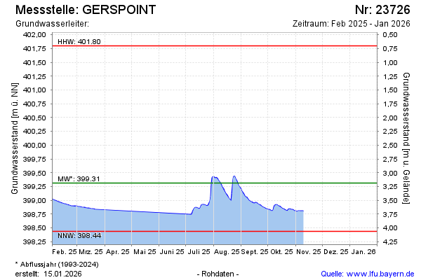
| Date | Groundwater level [m above sealevel] |
|---|---|
| 15.03.2026 | 399.03 |
| 14.03.2026 | 399.04 |
| 13.03.2026 | 399.06 |
| 12.03.2026 | 399.07 |
| 11.03.2026 | 399.09 |
| 10.03.2026 | 399.11 |
| 09.03.2026 | 399.13 |
| 08.03.2026 | 399.15 |