
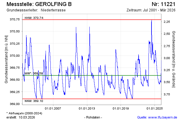
Chart of total period GEROLFING B
Groundwater level [m above sealevel]: 369.51
Distance to surface [m]: 3.44
Last value from 01.07.2026 10:00
Ground level [m above sealevel]: 372.95
| Date | Groundwater level [m above sealevel] |
|---|---|
| 01.07.2026 | 369.51 |
| 30.06.2026 | 369.51 |
| 29.06.2026 | 369.52 |
| 28.06.2026 | 369.52 |
| 27.06.2026 | 369.53 |
| 26.06.2026 | 369.53 |
| 25.06.2026 | 369.53 |
| 24.06.2026 | 369.54 |