
- Start >
- Groundwater >
- Waterlevel of upper layer >
- Bayern >
- Gerlenhofen, nördlich an Biotopfläche >
- Current data

Current data Gerlenhofen, nördlich an Biotopfläche
Groundwater levels of the last 12 months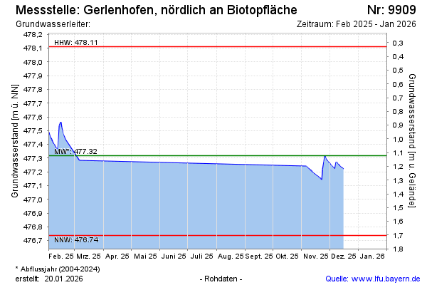
Groundwater level [m above sealevel]: 477.52
Distance to surface [m]: 0.92
Last value from 05.03.2026 13:46
Ground level [m above sealevel]: 478.44
| Date | Groundwater level [m above sealevel] |
|---|---|
| 05.03.2026 | 477.53 |
| 04.03.2026 | 477.53 |
| 03.03.2026 | 477.55 |
| 02.03.2026 | 477.57 |
| 01.03.2026 | 477.58 |
| 28.02.2026 | 477.61 |
| 27.02.2026 | 477.63 |
| 26.02.2026 | 477.66 |
© Bayerisches Landesamt für Umwelt 2026