
- Start >
- Groundwater >
- Waterlevel of upper layer >
- Bayern >
- GERLENHOFEN 7B >
- Chart of total period

Chart of total period GERLENHOFEN 7B
Groundwater levels of the total period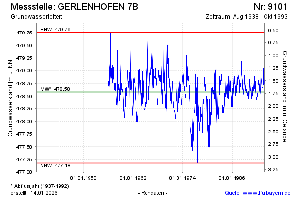
Groundwater level [m above sealevel]: 478.91
Distance to surface [m]: 1.39
Last value from 25.10.1993 12:00
Ground level [m above sealevel]: 480.30
| Date | Groundwater level [m above sealevel] |
|---|---|
| 18.10.1993 | 478.79 |
| 11.10.1993 | 478.76 |
| 04.10.1993 | 478.75 |
| 27.09.1993 | 478.76 |
| 20.09.1993 | 478.78 |
| 13.09.1993 | 478.84 |
| 06.09.1993 | 478.86 |
| 30.08.1993 | 478.88 |
© Bayerisches Landesamt für Umwelt 2026