
- Start >
- Groundwater >
- Waterlevel of upper layer >
- Bayern >
- Ger-G GEROLFING >
- Chart of total period

Chart of total period Ger-G GEROLFING
Groundwater levels of the total period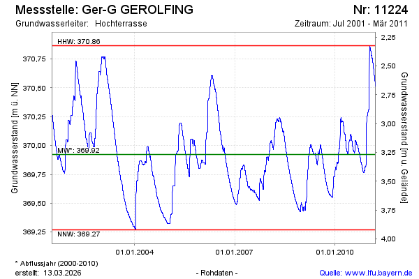
Groundwater level [m above sealevel]: 370.52
Distance to surface [m]: 2.67
Last value from 23.03.2011 11:00
Ground level [m above sealevel]: 373.19
| Date | Groundwater level [m above sealevel] |
|---|---|
| 23.03.2011 | 370.52 |
| 22.03.2011 | 370.52 |
| 21.03.2011 | 370.53 |
| 20.03.2011 | 370.53 |
| 19.03.2011 | 370.54 |
| 18.03.2011 | 370.55 |
| 17.03.2011 | 370.55 |
| 16.03.2011 | 370.56 |
© Bayerisches Landesamt für Umwelt 2026