
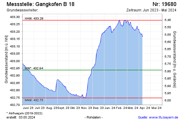
Current data Gangkofen B 18
Groundwater level [m above sealevel]: 432,80
Distance to surface [m]: 5,93
Last value from 15.06.2026 10:47
Ground level [m above sealevel]: 438.73
| Date | Groundwater level [m above sealevel] |
|---|---|
| 15.06.2026 | 432.80 |
| 14.06.2026 | 432.80 |
| 13.06.2026 | 432.80 |
| 12.06.2026 | 432.79 |
| 11.06.2026 | 432.79 |
| 10.06.2026 | 432.79 |
| 09.06.2026 | 432.79 |
| 08.06.2026 | 432.80 |