
- Start >
- Groundwater >
- Waterlevel of upper layer >
- Bayern >
- G3 HRB Feldolling >
- Chart of total period

Chart of total period G3 HRB Feldolling
Groundwater levels of the total period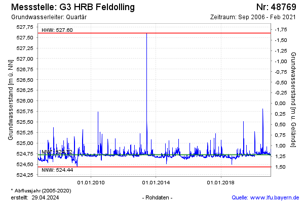
note
Die Messstelle wurde zurück gebaut.
Groundwater level [m above sealevel]: 524.79
Distance to surface [m]: 6.28
Last value from 02.02.2021 10:12
Ground level [m above sealevel]: 531.07
| Date | Groundwater level [m above sealevel] |
|---|---|
| 02.02.2021 | 524.80 |
| 01.02.2021 | 524.80 |
| 31.01.2021 | 524.83 |
| 30.01.2021 | 524.83 |
| 29.01.2021 | 524.85 |
| 28.01.2021 | 524.76 |
| 27.01.2021 | 524.73 |
| 26.01.2021 | 524.73 |
© Bayerisches Landesamt für Umwelt 2026