
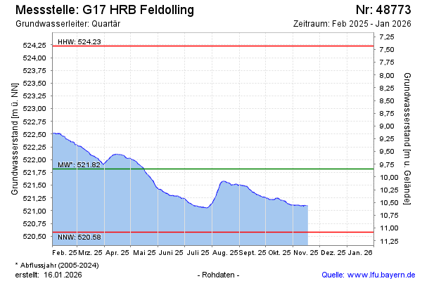
Current data G17 HRB Feldolling
Groundwater level [m above sealevel]: 521.30
Distance to surface [m]: 10.36
Last value from 04.02.2026 14:38
Ground level [m above sealevel]: 531.66
| Date | Groundwater level [m above sealevel] |
|---|---|
| 04.02.2026 | 521.29 |
| 03.02.2026 | 521.29 |
| 02.02.2026 | 521.31 |
| 01.02.2026 | 521.31 |
| 31.01.2026 | 521.31 |
| 30.01.2026 | 521.32 |
| 29.01.2026 | 521.33 |
| 28.01.2026 | 521.35 |