
- Start >
- Groundwater >
- Waterlevel of upper layer >
- Bayern >
- G11 HRB Feldolling >
- Chart of total period

Chart of total period G11 HRB Feldolling
Groundwater levels of the total period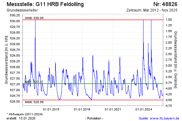
Groundwater level [m above sealevel]: 526.84
Distance to surface [m]: 4.22
Last value from 04.02.2026 15:17
Ground level [m above sealevel]: 531.06
| Date | Groundwater level [m above sealevel] |
|---|---|
| 04.02.2026 | 526.85 |
| 03.02.2026 | 526.86 |
| 02.02.2026 | 526.86 |
| 01.02.2026 | 526.87 |
| 31.01.2026 | 526.87 |
| 30.01.2026 | 526.88 |
| 29.01.2026 | 526.88 |
| 28.01.2026 | 526.89 |
© Bayerisches Landesamt für Umwelt 2026