
- Start >
- Groundwater >
- Waterlevel of upper layer >
- Bayern >
- G10 HRB Feldolling >
- Chart of total period

Chart of total period G10 HRB Feldolling
Groundwater levels of the total period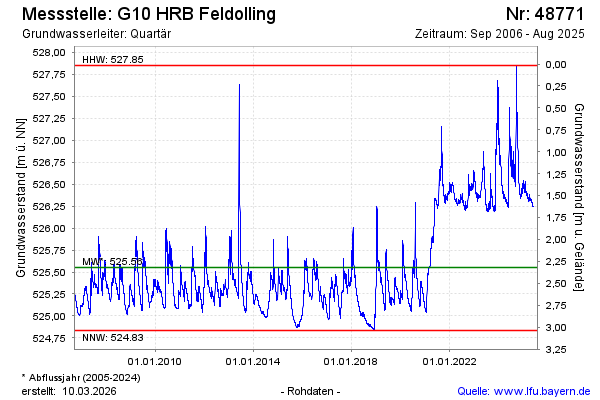
Groundwater level [m above sealevel]: 526.41
Distance to surface [m]: 1.46
Last value from 07.08.2025 10:00
Ground level [m above sealevel]: 527.87
| Date | Groundwater level [m above sealevel] |
|---|---|
| 27.05.2025 | 526.25 |
| 26.05.2025 | 526.25 |
| 25.05.2025 | 526.25 |
| 24.05.2025 | 526.25 |
| 23.05.2025 | 526.25 |
| 22.05.2025 | 526.25 |
| 21.05.2025 | 526.25 |
| 20.05.2025 | 526.26 |
© Bayerisches Landesamt für Umwelt 2026