
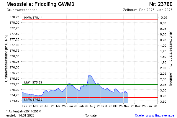
Current data Fridolfing GWM3
Groundwater level [m above sealevel]: 375.09
Distance to surface [m]: 2.8800000000001
Last value from 05.03.2026 11:00
Ground level [m above sealevel]: 377.97
| Date | Groundwater level [m above sealevel] |
|---|---|
| 05.03.2026 | 375.10 |
| 04.03.2026 | 375.10 |
| 03.03.2026 | 375.10 |
| 02.03.2026 | 375.10 |
| 01.03.2026 | 375.10 |
| 28.02.2026 | 375.09 |
| 27.02.2026 | 375.06 |
| 26.02.2026 | 375.01 |