
- Start >
- Groundwater >
- Waterlevel of upper layer >
- Bayern >
- FREIHUNGSAND II 657 >
- Current data

Current data FREIHUNGSAND II 657
Groundwater levels of the last 12 months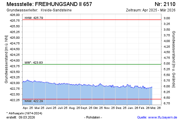
Groundwater level [m above sealevel]: 422.70
Distance to surface [m]: 6.16
Last value from 22.05.2026 04:00
Ground level [m above sealevel]: 428.86
| Date | Groundwater level [m above sealevel] |
|---|---|
| 21.05.2026 | 422.70 |
| 20.05.2026 | 422.72 |
| 19.05.2026 | 422.73 |
| 18.05.2026 | 422.75 |
| 17.05.2026 | 422.75 |
| 16.05.2026 | 422.78 |
| 15.05.2026 | 422.82 |
| 14.05.2026 | 422.83 |
© Bayerisches Landesamt für Umwelt 2026