
- Start >
- Groundwater >
- Waterlevel of upper layer >
- Bayern >
- FRAUENRIEDHAUSEN D 48 >
- Chart of total period

Chart of total period FRAUENRIEDHAUSEN D 48
Groundwater levels of the total period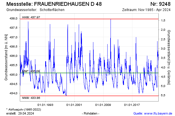
Groundwater level [m above sealevel]: 435.65
Distance to surface [m]: 3.74
Last value from 26.07.2024 09:00
Ground level [m above sealevel]: 439.39
| Date | Groundwater level [m above sealevel] |
|---|---|
| 26.07.2024 | 435.65 |
| 25.07.2024 | 435.66 |
| 24.07.2024 | 435.66 |
| 23.07.2024 | 435.67 |
| 22.07.2024 | 435.69 |
| 21.07.2024 | 435.73 |
| 20.07.2024 | 435.76 |
| 19.07.2024 | 435.76 |
© Bayerisches Landesamt für Umwelt 2024