
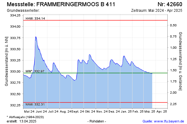
Current data FRAMMINGERMOOS B 411
Groundwater level [m above sealevel]: 332,71
Distance to surface [m]: 1,82
Last value from 30.06.2026 10:50
Ground level [m above sealevel]: 334.53
| Date | Groundwater level [m above sealevel] |
|---|---|
| 30.06.2026 | 332.71 |
| 29.06.2026 | 332.65 |
| 28.06.2026 | 332.65 |
| 27.06.2026 | 332.66 |
| 26.06.2026 | 332.67 |
| 25.06.2026 | 332.67 |
| 24.06.2026 | 332.68 |
| 23.06.2026 | 332.69 |