
Current data FORSTINNING 511
note
Die Messstelle wird wöchentlich beobachtet.
Groundwater level [m above sealevel]: 505.24
Distance to surface [m]: 6.75
Last value from 31.05.2026 10:00
Ground level [m above sealevel]: 511.99
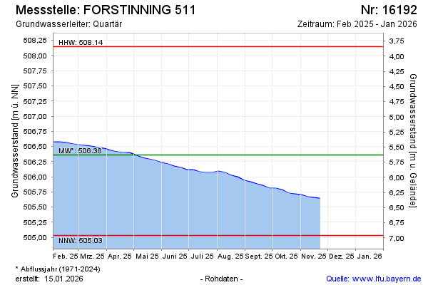
| Date | Groundwater level [m above sealevel] |
|---|---|
| 24.05.2026 | 505.26 |
| 17.05.2026 | 505.27 |
| 10.05.2026 | 505.27 |
| 03.05.2026 | 505.29 |
| 26.04.2026 | 505.31 |
| 19.04.2026 | 505.33 |
| 12.04.2026 | 505.34 |
| 05.04.2026 | 505.36 |