
- Start >
- Groundwater >
- Waterlevel of upper layer >
- Bayern >
- Flussraummanagement Vils ZA 21 >
- Current data

Current data Flussraummanagement Vils ZA 21
Groundwater levels of the last 12 months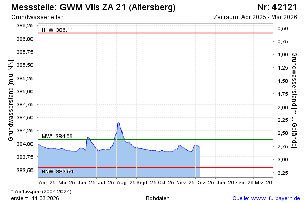
Groundwater level [m above sealevel]: 383.95
Distance to surface [m]: 2.75
Last value from 25.03.2026 11:35
Ground level [m above sealevel]: 386.70
| Date | Groundwater level [m above sealevel] |
|---|---|
| 25.03.2026 | 383.95 |
| 24.03.2026 | 383.95 |
| 23.03.2026 | 383.97 |
| 22.03.2026 | 383.98 |
| 21.03.2026 | 383.99 |
| 20.03.2026 | 384.00 |
| 19.03.2026 | 384.01 |
| 18.03.2026 | 384.03 |
© Bayerisches Landesamt für Umwelt 2026