
Chart of total period FESSENHEIM 46
Groundwater level [m above sealevel]: 408,57
Distance to surface [m]: 2,20
Last value from 15.06.2003 10:00
Ground level [m above sealevel]: 410.77
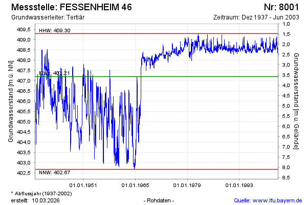
| Date | Groundwater level [m above sealevel] |
|---|---|
| 08.06.2003 | 408.31 |
| 01.06.2003 | 408.32 |
| 25.05.2003 | 408.34 |
| 18.05.2003 | 408.35 |
| 11.05.2003 | 408.35 |
| 04.05.2003 | 408.33 |
| 27.04.2003 | 408.36 |
| 20.04.2003 | 408.40 |