
- Start >
- Groundwater >
- Waterlevel of upper layer >
- Bayern >
- FELDKIRCHEN 116A >
- Year chart of precipitation

Year chart of precipitation FELDKIRCHEN 116A
Groundwater levels of the last 12 months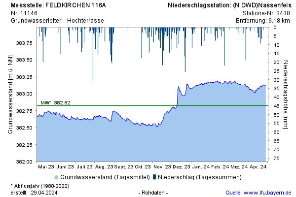
Groundwater level [m above sealevel]: 382,71
Distance to surface [m]: 6,18
Last value from 06.03.2026 11:00
Ground level [m above sealevel]: 388.89
© Bayerisches Landesamt für Umwelt 2026