
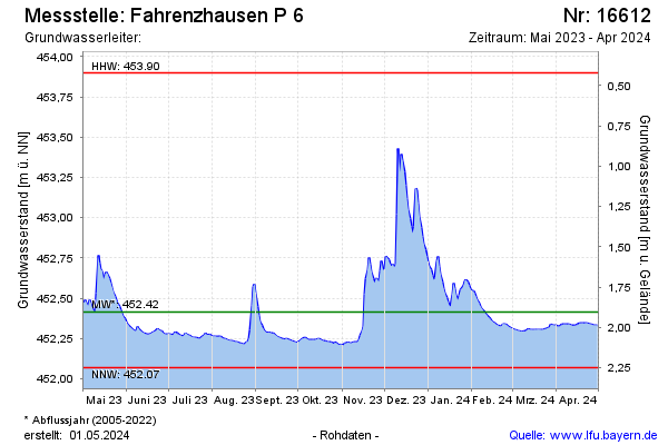
Current data Fahrenzhausen P 6
Groundwater level [m above sealevel]: 452,23
Distance to surface [m]: 2,09
Last value from 22.07.2026 10:00
Ground level [m above sealevel]: 454.32
| Date | Groundwater level [m above sealevel] |
|---|---|
| 22.07.2026 | 452.23 |
| 21.07.2026 | 452.23 |
| 20.07.2026 | 452.23 |
| 19.07.2026 | 452.23 |
| 18.07.2026 | 452.24 |
| 17.07.2026 | 452.24 |
| 16.07.2026 | 452.24 |
| 15.07.2026 | 452.24 |