
- Start >
- Groundwater >
- Waterlevel of upper layer >
- Bayern >
- ERLENBACH 98 >
- Chart of total period

Chart of total period ERLENBACH 98
Groundwater levels of the total period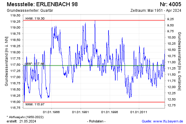
Groundwater level [m above sealevel]: 117.62
Distance to surface [m]: 10.99
Last value from 24.03.2026 09:30
Ground level [m above sealevel]: 128.61
| Date | Groundwater level [m above sealevel] |
|---|---|
| 24.03.2026 | 117.62 |
| 23.03.2026 | 117.62 |
| 22.03.2026 | 117.63 |
| 21.03.2026 | 117.63 |
| 20.03.2026 | 117.62 |
| 19.03.2026 | 117.61 |
| 18.03.2026 | 117.60 |
| 17.03.2026 | 117.60 |
© Bayerisches Landesamt für Umwelt 2026