
- Start >
- Groundwater >
- Waterlevel of upper layer >
- Bayern >
- Erding-Klettham 2 >
- Current data

Current data Erding-Klettham 2
Groundwater levels of the last 12 months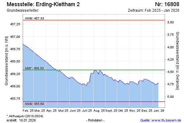
Groundwater level [m above sealevel]: 456.36
Distance to surface [m]: 4.43
Last value from 16.04.2026 09:00
Ground level [m above sealevel]: 460.79
| Date | Groundwater level [m above sealevel] |
|---|---|
| 16.04.2026 | 456.36 |
| 15.04.2026 | 456.37 |
| 14.04.2026 | 456.37 |
| 13.04.2026 | 456.38 |
| 12.04.2026 | 456.39 |
| 11.04.2026 | 456.39 |
| 10.04.2026 | 456.39 |
| 09.04.2026 | 456.39 |
© Bayerisches Landesamt für Umwelt 2026