
- Start >
- Groundwater >
- Waterlevel of upper layer >
- Bayern >
- EPPISBURG 459A >
- Chart of total period

Chart of total period EPPISBURG 459A
Groundwater levels of the total period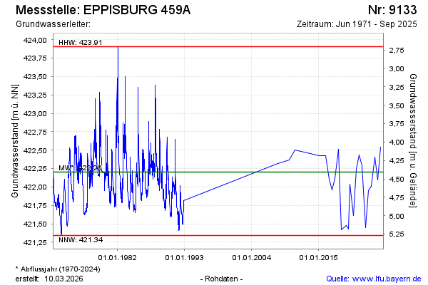
Groundwater level [m above sealevel]: 422.63
Distance to surface [m]: 3.98
Last value from 03.03.2026 10:00
Ground level [m above sealevel]: 426.61
| Date | Groundwater level [m above sealevel] |
|---|---|
| 09.09.2025 | 421.75 |
| 24.02.2025 | 422.54 |
| 27.08.2024 | 422.10 |
| 11.04.2024 | 422.41 |
| 04.09.2023 | 422.01 |
| 23.02.2023 | 421.95 |
| 02.09.2022 | 421.45 |
| 17.02.2022 | 422.29 |
© Bayerisches Landesamt für Umwelt 2026