
- Start >
- Groundwater >
- Waterlevel of upper layer >
- Bayern >
- Enterrottach 1 >
- Current data

Current data Enterrottach 1
Groundwater levels of the last 12 months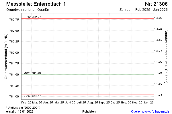
note
Die Messstelle wird nicht mehr beobachtet.
Groundwater level [m above sealevel]: 781.43
Distance to surface [m]: 4.36
Last value from 12.05.2025 10:00
Ground level [m above sealevel]: 785.79
| Date | Groundwater level [m above sealevel] |
|---|---|
| 01.10.2024 | 781.42 |
| 14.05.2024 | 781.48 |
| 13.10.2023 | 781.29 |
| 11.10.2023 | 781.29 |
| 01.10.2023 | -- |
| 30.09.2023 | -- |
| 29.09.2023 | -- |
| 28.09.2023 | -- |
© Bayerisches Landesamt für Umwelt 2026